
Navigating Seoul City
By bus, train, or foot
TRANSPORTATION !
When people asked me what I was most excited about on our upcoming Asia adventure, one of the first things I'd say was the chance to ride the bullet trains. So, it's fair to say I had high expectations for the quality of public transit, especially in Korea. I haven't even gotten to try out the high-speed rail yet, and still, my expectations have been exceeded.
History and context
For perspective, know that Seoul is one of the world's largest mega cities, with the metro region estimated to house just over 25 million people in a city just over 230 square miles. The city is completely surrounded by mountains and has a lot of preserved open space but 85 percent of people live in apartments and of those 65% are in high-rises.1 The city transit system includes a subway system and a bus system (including bus only lanes and bus rapid transit [BRT]). From the Seoul history museum, I was intrigued to learn that the subway system and bus system here is relatively new; built out in the late 1960's through 1970's, which was a big boom period for the capital. Before that, like many cities, Seoul had some small-scale trams, which quickly gave way to the car. But when mass migration to the city started happening after World War II, Korea addressed the housing crisis and transportation crisis quickly and decisively. By the 1980's ridership of transit went from less than 30% of trips to the vast majority of trips as the subway and bus system was rapidly built out.
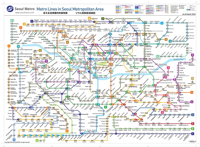
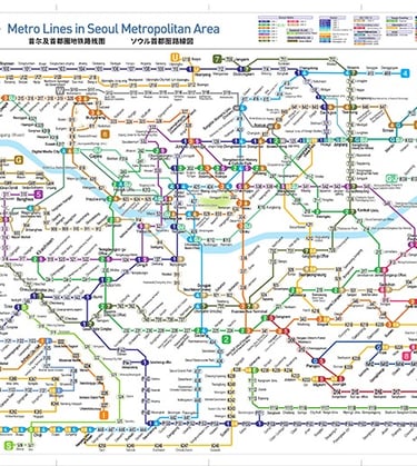
The Seoul Metropolitan Area subway system covers an expansive area, including Line 1 to 9 with additional lines, such as the Incheon Aiport line, Sinbundang Line, Gyeongchun Line, and a few other suburban lines. The central numbered lines generally run semi-circuits across the city. These are supplemented by a large number of bus lines.2
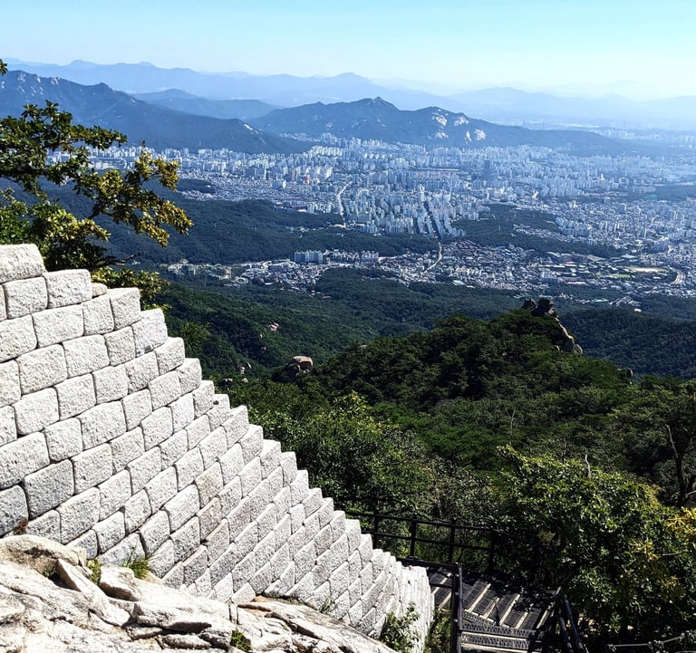
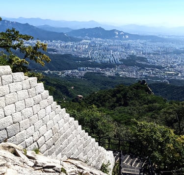
I was absolutely delighted that we were able to go from central Seoul to the very foothills of Bukansan National Park (located on the northern fringes of Seoul) all via subway. Requiring only one transfer, this took less than 45 minutes. At the end of the trail, we took a similarly easy bus journey back.3
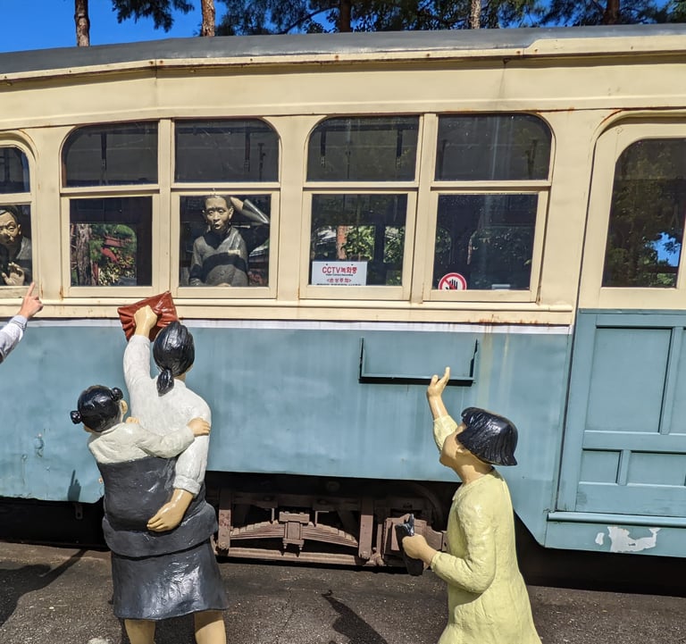
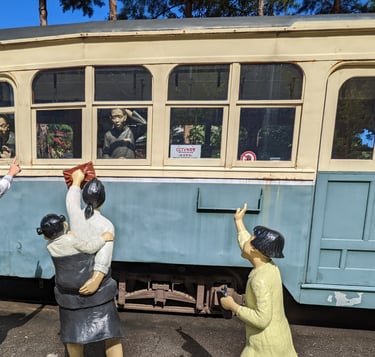
Here I pose with a reproduction tram and 1930's era transit riders outside the Seoul History Museum
Footnotes
1) According to the Korean Statistical Information Service
2) There is a also a pretty robust Citybike program and bike infrastructure in the city, part of what appears to be a very strong national preference for bicycling, but I plan to write more about that in a separate blog. As of this blog writing, we hadn't figured out how to successfully use Citybikes with our foreign credit cards.
3) Bukansan National Park may also deserve a post of its own, to share our photos of the beautiful views, if nothing else. So, stay tuned.
4) According to a potentially unreliable internet source I found, South Korea doesn't allow Google Maps so as to prevent North Korea from getting valuable intel on travel times and distances in-country.
The subway system initially looks very complicated, but is ultimately easy to navigate with a helpful Naver app as your companion
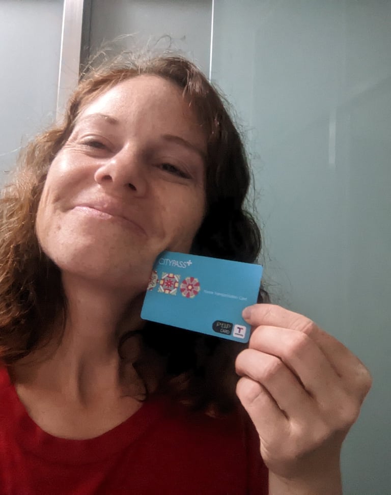

Here I'm showing off my beloved T-Money card. Even older T-Money cards work no problem; this one was passed on from a friend who lived in Korea several years ago (thanks Jenny!)
Navigating Transit
A fun fact for you all: South Korea is the only country in the world that does not fully allow Google Maps access.4 This, combined with the use of Hangul characters as the written language, initially made navigation of the transit system daunting. But Shadie, a transit natural I'd say, picked up on it in less than a day, while I got comfortable after a second day.
So, how does it work? Well, firstly, while Google maps has major gaps, other local apps like Naver, which was recommended to us by some friends and colleagues who've lived here (thanks guys!), are intuitive and very comprehensive in sharing routes, times, and where to go. Secondly, the system has mercifully included sub-headings of the stops in Latin alphabet in addition to Hangul on most signs at critical junctures.
Finding your way on a subway has three steps/parts. 1) find the line (aka line 1, 2, 3 etc.) which you can ID via the number or the line color. At a station with multiple lines, you follow signs for the line you want until you descend toward the right platform. 2) follow arrow indicators for direction via the next stop and last stop of the line. 3) to facilitate the full efficiency of transfers, you board the right car based on numbering of the entrance doors. 4) Upon exiting the subway train, follow arrows to your desired exit numbers (the stations are so large, that getting out at the right exit can save a lot of walking time). Follow these 4 steps, and you're bound to have a highly efficient journey even with multiple transfers. Each subway seems to arrive with a three-to-five-minute headway no matter what time it is (until 1AM) or how suburban the stop.
Buses are more standard, with stops marked by signs along the side of the street, and simple but well-appointed shelters and benches. Some, but not all have, virtual readout of arrival time, and some but not all, have a dedicated bus lanes. While buses also arrive with astounding frequency, they do get held up occasionally by the traffic that still snarls the streets at rush-hour. Shadie sadly missed two beloved Crossfit sessions because protest marches or traffic incidents badly delayed his bus across center of town.
Payment
What I find nearly as delightful as the frequency and breadth and the clear navigational system of the transit system, is the payment system! Koreans use a T-Money Card. This card, much like BART, MTA and others in the use is a card you can purchase for a nominal fee and then top off via machines or online as needed. But what is so dang cool about T-Money is that not only does it work on Seoul subway and every regional subway system, and all the buses, but also on virtually every transit system in the country. Some special versions of T-Money cards also mysteriously work at convenience stores and markets, as well. Imagine if your BART card worked on Denver's RTD buses, NYC's MTA, and DC's Metro and the 7-Eleven across the street!

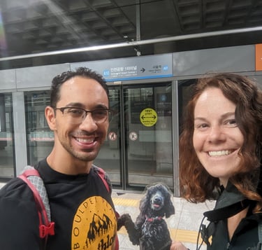
Shadie, Winnie Standup, and I pose in front of the subway doors on the way from the airport. Up above it displays the line (blue, A10), direction (Seoul Station), and hidden behind us, there would also be a door number that allows for easy transfer.
The Seoul series of super-tall matching apartment complexes were described in one museum quote as a "forest of tall white trees." And up high from Bukansan peak, I could see why.
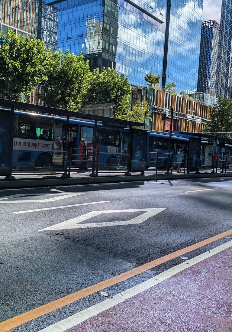
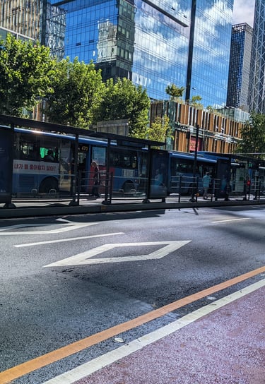
This roadway featured center-running bus rapid transit (like Denver will eventually build on Colfax Ave) at the top left, and a bike lane at the bottom right, which in South Korea are usually painted red. Unlike in the US, the white diamonds do not indicate a HOV lane, but instead warn of a pedestrian crossing ahead.